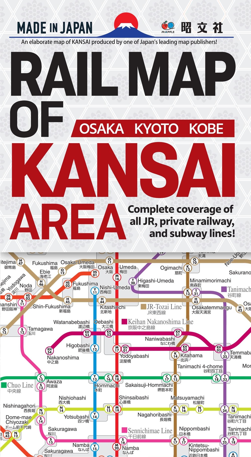
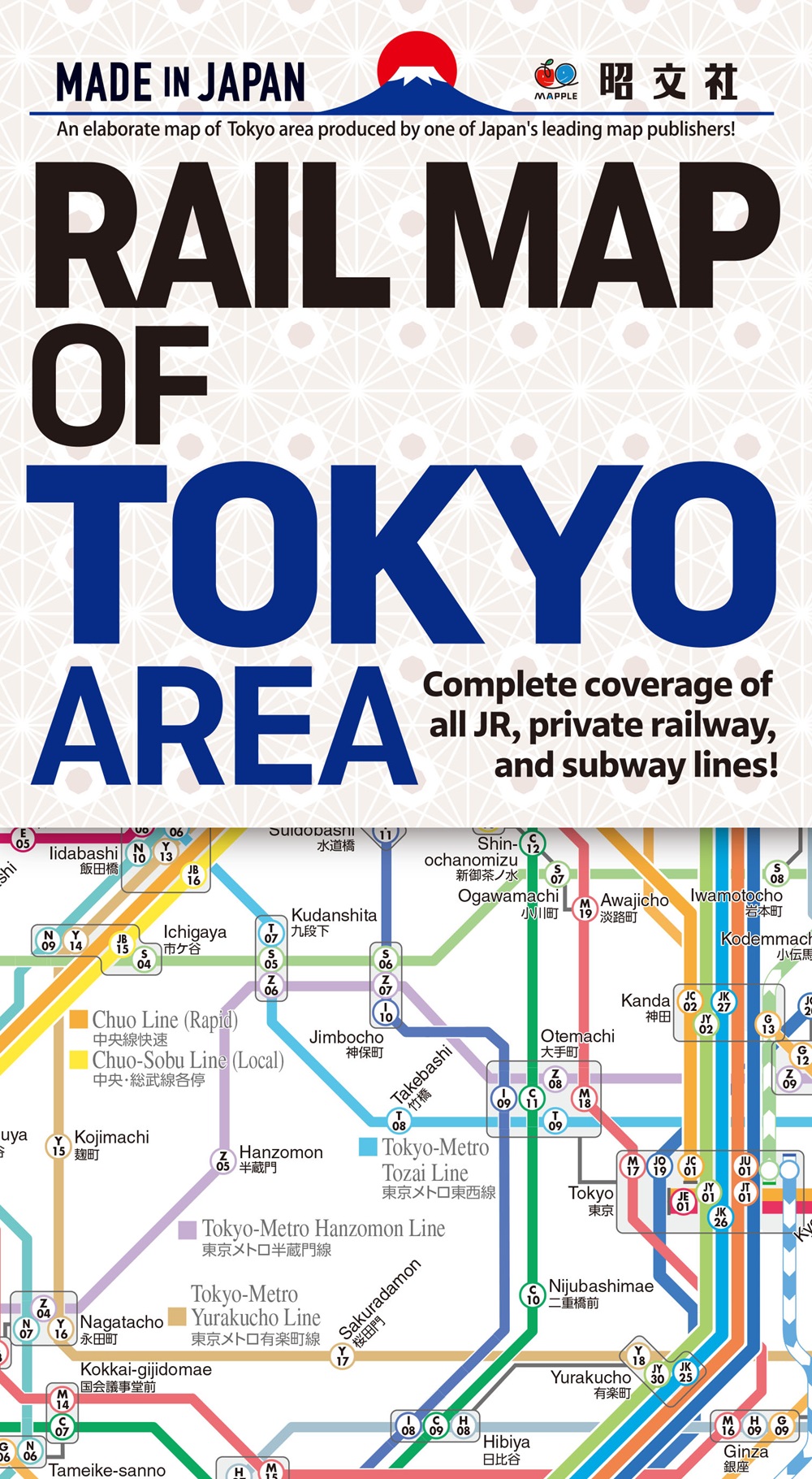
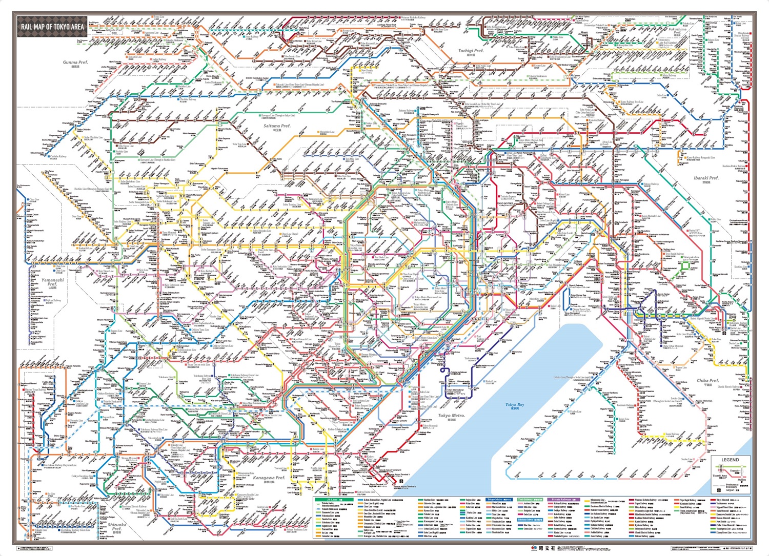
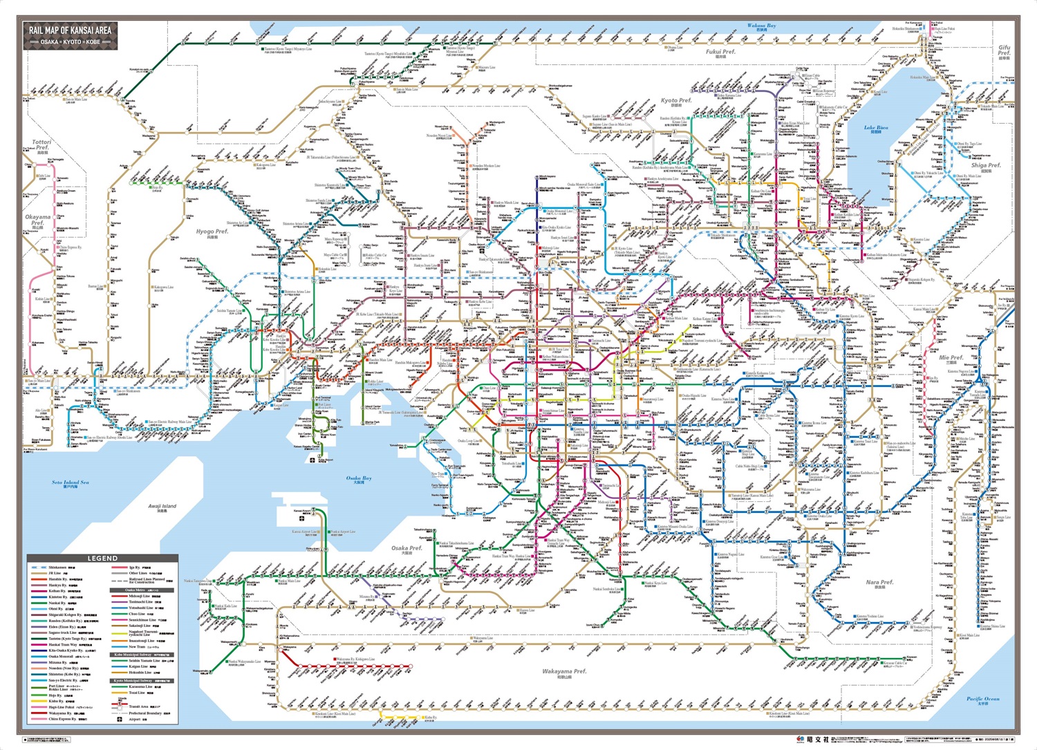
An elaborate map of KANSAI produced by one of Japan’s leading map publishers! Complete coverage of all JR, private railway, and subway lines!
●Shobunsha maps are amazing for the following reasons.
・Accuracy:
Their accuracy is world-class, depicting Japan’s intricate terrain in detail and with precision.
・Map information:
We constantly research and update our maps with vast amounts of ever-changing information, including roads, railways, and place names.
・Design:
Packed with mapmaking expertise accumulated over the years since our founding in 1960, and dedication as map specialists. Our maps are used by many people and have earned a high reputation.
●Specifications
Front side:
Kinki region railway map
Japanese and English bilingual
Back side:
Map of the Kinki region showing major stations and major tourist attractions. Scale: 1:300,000
Japanese and English bilingual. In densely populated areas of the city center, some stations are omitted.